
Solar Compass: History, Design, and Operation of Burt’s Instrument
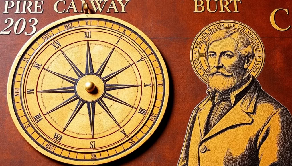
A solar compass is a surveying instrument that determines the true meridian by using the Sun’s calculated position rather than relying only on a magnetic needle. William Austin Burt developed the best-known American version in the 1830s after magnetic disturbances complicated land surveys in iron-bearing regions. Burt’s instrument was not simply a plate that indicated direction from a shadow. It combined astronomical settings, precision arcs, sights, levels, and a surveyor’s compass so an operator could establish true north and measure bearings. This guide explains its historical development, physical construction, operating principle, field procedure, reception, and lasting importance in American surveying.
Table of Contents:
History of the Solar Compass
Sun-Based Direction Finding Before Burt
People used the Sun to estimate direction long before the invention of precision surveying instruments. The direction and length of a shadow could indicate the time of day, help establish an east–west line, or support the construction of sundials and aligned structures. Navigators also learned to relate the Sun’s daily path to the cardinal directions.
These methods provided the conceptual background for later solar instruments, but they were not equivalent to Burt’s solar compass. His design turned astronomical information into a mechanical surveying system capable of establishing a true meridian and measuring land bearings with much greater control. This development belongs within the broader history of compass invention, but it solved a specifically nineteenth-century surveying problem.
William Austin Burt and the Surveying Problem
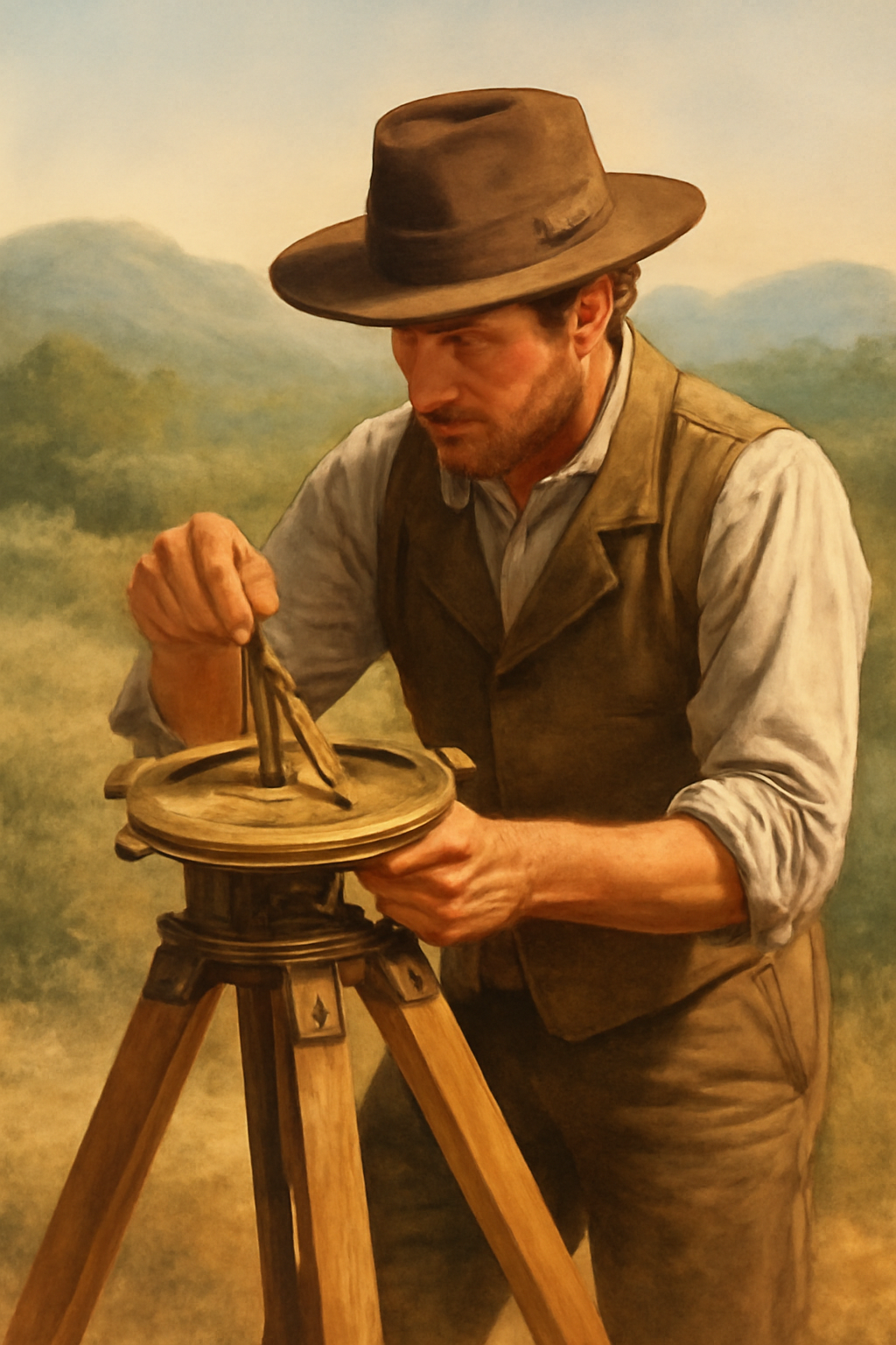
William Austin Burt was an American surveyor, mechanic, and inventor who worked as a United States deputy surveyor during the expansion of the federal public-land system. Surveyors normally used a magnetic compass to run boundary lines and record bearings. That approach was fast and practical, but it depended on a magnetic needle behaving predictably.
While surveying in Michigan, Burt encountered areas where iron-bearing rocks produced local magnetic attraction. The compass needle could deviate from its expected direction, sometimes changing as the crew moved across the terrain. Regional magnetic variation added another complication because magnetic north does not coincide with true north and does not remain constant everywhere.
Burt therefore needed a way to establish the true north–south line without depending on the local magnetic field. The Sun offered a stable astronomical reference: if the observer’s latitude, the date, and the correct time were known, the Sun’s direction could be calculated. Modern instruments such as a magnetometer can measure magnetic anomalies directly, but nineteenth-century field crews needed a mechanical solution that worked during an ordinary land survey.
Invention, Patent, and Early Improvements
Burt developed a working concept in 1835 and asked Philadelphia instrument maker William J. Young to construct a model. He received U.S. Patent No. 9428X on February 25, 1836. Early forms were closely related to the ordinary surveyor’s compass and added a solar apparatus that allowed the operator to determine the true meridian and compare it with the magnetic needle.
The Franklin Institute examined Burt’s compass apparatus and recognized the invention with a Scott Medal. Burt continued refining the design because the first model was not yet convenient enough for routine fieldwork. By about 1840, he had developed a more practical version and Young began producing instruments in Philadelphia. Changes included improved verniers, clamps, and tangent-screw adjustments that allowed settings to be made more accurately.
As the design matured, other makers produced solar compasses and related attachments. Later nineteenth-century examples were manufactured by firms such as W. & L. E. Gurley of Troy, New York. These instruments varied in size and detail, but retained Burt’s central idea: use astronomical geometry to establish the true meridian, then use the surveying plate and sights to measure terrestrial bearings.
Later Sun Compass Designs
Other sun compasses appeared for different tasks and should not automatically be treated as copies of Burt’s instrument. Ralph Bagnold, for example, developed a vehicle-mounted sun compass for desert travel in the twentieth century. It used the Sun’s azimuth and a shadow-casting element to maintain a course where steel vehicles could disturb magnetic compasses. The Bagnold sun compass later became associated with the Long Range Desert Group during World War II, but its purpose, construction, and operating method differed from Burt’s precision land-surveying instrument.
Description of Burt’s Solar Compass
Main Components and Physical Construction
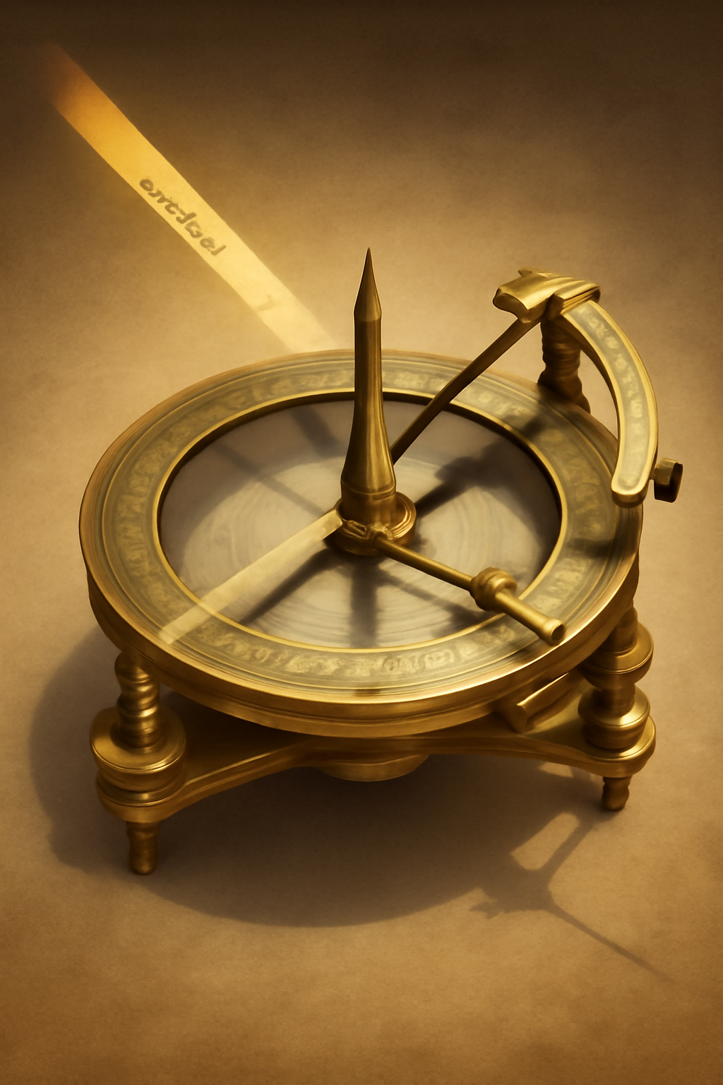
Burt’s solar compass was a complex brass surveying instrument mounted on a tripod, not a simple gnomon and shadow plate. A main plate supported the compass assembly and the solar mechanism. Two spirit levels placed at right angles allowed the surveyor to level the instrument, an essential step because the astronomical settings assumed a horizontal reference plane.
The instrument generally included an upper plate associated with the solar apparatus and a lower rotating plate carrying the terrestrial sights. A graduated horizontal circle and opposite verniers—small auxiliary scales used to read fractions of the main divisions—showed the angle between the true-meridian reference and the line of sight toward a landmark. Clamps and tangent screws allowed the operator to lock a position and make fine adjustments.
The solar mechanism contained three principal angular settings:
- Latitude arc: adjusted for the observer’s geographic latitude and used to relate the instrument to Earth’s rotational axis.
- Declination arc: set for the Sun’s angular position north or south of the celestial equator on the date of observation.
- Hour arc: set according to the Sun’s position for the relevant local solar time.
A small lens projected an image of the Sun onto a target marked with crossed or parallel reference lines. When the solar image was correctly centered, the geometry of the arcs indicated that the instrument had been aligned with the true meridian. Separate sighting vanes, and on some later examples an auxiliary telescope, were then used to take bearings on terrestrial objects.
Surviving instruments show that dimensions varied by maker and period. An early William J. Young example in the Smithsonian collection, probably made around 1840, measures approximately 9⅜ by 14 5/16 by 6¾ inches for the compass assembly. A later W. & L. E. Gurley instrument made around 1880 was larger and included a patented auxiliary telescope.
Principle of Operation
The solar compass works because the Sun’s apparent direction can be predicted for a known place and time. Its position in the sky depends primarily on the observer’s latitude, the Sun’s declination for the date, and the hour angle—the Sun’s apparent movement east or west of the local meridian as the day progresses.
The latitude setting tilted the instrument’s astronomical axis so that it corresponded to Earth’s polar axis at the survey location. The declination setting accounted for the seasonal change in the Sun’s apparent path. The hour setting represented the Sun’s position at the selected local solar time. Together, these adjustments created a mechanical model of where the Sun should appear relative to the true north–south line.
The surveyor then rotated and fine-tuned the compass until the lens placed the Sun’s image correctly on the target. Once that alignment was achieved, the upper reference plate was oriented to the true meridian. The lower plate and its sights could then rotate independently so the bearing of a boundary line, landmark, or survey station could be read relative to true north.
This method did not require the magnetic needle to define north. The needle could remain useful for measuring magnetic variation, but iron deposits or other local attraction did not control the astronomical alignment. Readers unfamiliar with the difference can compare this process with how a magnetic compass works.
Construction and Operation
Operating Burt’s solar compass required astronomical data and careful mechanical adjustment. The following sequence describes the general procedure for this instrument rather than a universal method for every sun compass:
- Level the instrument. The compass was mounted on its tripod and adjusted until both spirit levels indicated that the main plate was horizontal.
- Set the latitude. The surveyor placed the latitude arc at the known or estimated latitude of the observation point.
- Set the Sun’s declination. A solar table or ephemeris supplied the declination for the date, including its north or south designation.
- Establish the correct time reference. Clock time had to be converted or corrected to the local solar time required by the instrument. Errors in longitude, clock setting, or time correction would shift the expected solar position.
- Set the hour arc and face the Sun. The approximate hour angle was entered, and the assembly was turned until sunlight passed through the lens toward the marked target.
- Center the solar image. The operator used the fine-adjustment screws to bring the Sun’s image between the reference lines in both directions. This confirmed the required astronomical alignment.
- Lock the meridian and take bearings. Once the upper plate represented true north–south, the lower sights could be turned toward a survey point. The graduated circle and verniers provided its bearing from the true meridian.
Surveyors could also compare the astronomical meridian with the attached magnetic needle to determine local magnetic variation. That feature made the solar compass useful not only for running true bearings but also for evaluating how far the magnetic needle departed from the true meridian at a particular location.
Accuracy, Requirements, and Limitations
Burt’s instrument offered a major advantage in magnetically disturbed terrain, but it was not automatic or error-free. Accurate work required a visible Sun, reliable latitude, correct declination data, an appropriate local-time correction, precise leveling, properly adjusted arcs, and a skilled operator.
Cloud cover could interrupt observations, while small time errors produced angular errors because the Sun continually changes position. Worn screws, imperfect verniers, misaligned sights, or an incorrectly centered solar image also reduced accuracy. Near sunrise or sunset, refraction and rapidly changing geometry could complicate observations. The instrument therefore replaced one source of error—unreliable magnetism—with an astronomical method that demanded good data and disciplined field technique.
Solar Compass vs. Magnetic Compass
The two instruments were designed around different references and served different practical needs. A magnetic compass remained quicker for ordinary orientation, while Burt’s solar compass was especially valuable when a survey required a true meridian or when local attraction made the needle unreliable. Other types of compasses use still different references and mechanisms.
| Feature | Burt’s Solar Compass | Magnetic Compass |
|---|---|---|
| Reference used | Sun and astronomical settings | Earth’s magnetic field |
| Direction obtained | True meridian | Magnetic north |
| Effect of local magnetic anomalies | Does not depend on them for alignment | May be significantly affected |
| Weather requirement | Requires a visible Sun for solar observation | Does not require sunlight |
| Time and latitude data | Required for normal operation | Usually not required |
| Historical strength | Precise surveying in magnetically disturbed areas | Fast general orientation and ordinary bearings |
The distinction between true and magnetic north also explains why surveyors had to understand the history and limitations of the magnetic compass rather than treating every north reference as interchangeable.
Reception and Historical Significance
Recognition and Adoption
Burt’s invention attracted attention because it addressed a problem that surveyors understood immediately: a land line could not be trusted if the magnetic reference changed unpredictably. The Franklin Institute recognized his compass apparatus, and Burt continued to submit improved versions for technical examination. William J. Young’s production of practical instruments around 1840 helped move the design from experimental model to professional tool.
Adoption was gradual rather than instantaneous. The instrument required training and cost more than an ordinary compass, but its advantages became clear in government work. Federal surveying instructions issued during the nineteenth century specified Burt’s improved solar compass, or another instrument independent of the magnetic needle, where mineral attraction made ordinary compass work unreliable. Some instructions recommended such instruments even more broadly for important meridian and township lines.
Use in American Land Surveying
The solar compass was particularly suited to the rectangular public-land survey system. Surveyors had to establish principal and guide meridians, township boundaries, section lines, and other legal divisions that would later define property ownership. A persistent directional error could spread across many miles and affect an entire pattern of land parcels.
By establishing a true meridian astronomically, surveyors could run lines through areas where iron ore or local magnetic variation disrupted the needle. The instrument also allowed them to measure the variation between magnetic north and true north at the observation point. It became an important part of federal public-land surveying, especially in the American West and in mineral-bearing districts.
Surviving Instruments and Museum Collections
Original instruments survive in museums and surveying collections because they document both scientific design and the physical expansion of the United States. The Smithsonian preserves an early solar compass marked “Burts patent Made by Wm. J. Young Philada.,” probably made around 1840. Its later-added tangent screw shows how makers modified the design when field experience revealed that a hand-moved vernier was inconvenient.
The Smithsonian also holds a W. & L. E. Gurley solar compass made around 1880 that belonged to the U.S. Geological Survey. It includes a silvered horizontal circle, opposite verniers, and an auxiliary telescope. Such objects demonstrate that Burt’s basic concept continued to be manufactured in revised forms long after the original patent period.
Legacy and Later Solar Compasses
Burt’s principal contribution was to integrate astronomy with a field instrument that ordinary surveyors could use to establish a true direction. The solar compass helped separate legal land measurement from the uncertainties of local magnetic attraction and influenced later solar attachments for transits and other surveying instruments.
Later sun compasses addressed different environments. Bagnold’s design, developed for motor travel in the desert and later used by the Long Range Desert Group, relied on the Sun’s azimuth and a vehicle-mounted shadow system to maintain direction while moving. It shared Burt’s avoidance of magnetic interference but was not the same instrument and did not use the same surveying arcs and plate arrangement.
Electronic instruments, satellite positioning, and modern geodetic methods eventually displaced the solar compass from routine professional work. Its historical significance remains substantial, however, because it represents a successful mechanical answer to a real scientific and legal problem: how to establish dependable survey directions when the magnetic compass could not be trusted.
William Austin Burt’s solar compass transformed predictable celestial motion into a practical surveying reference. By combining latitude, solar declination, time, precision scales, and field sights, it allowed surveyors to establish the true meridian in places where magnetic attraction threatened reliable bearings. Its adoption in American public-land surveys and the surviving instruments preserved by museums reflect both its technical value and its historical role. The solar compass remains an important example of how astronomy, mechanics, and land surveying were brought together in a single field instrument.

Learn more about compasses: