
History of the Magnetic Compass: Origins and Evolution
The history of the magnetic compass spans more than a thousand years of documented development, from early Chinese experiments with magnetized needles to dry marine compasses, liquid-filled instruments, gyrocompasses, and electronic sensors. Its importance lies not in one isolated moment of invention, but in the way different societies adapted a simple magnetic principle to solve increasingly complex problems of navigation.
The earliest stages of this story began in China, where lodestone and magnetized needles were used for orientation before the compass became a practical aid for sailors. From there, magnetic direction finding appeared in the Islamic world and medieval Europe, where instrument makers introduced new mounting systems, compass cards, bearing mechanisms, and methods for correcting magnetic error.
This article follows the origins and evolution of the magnetic compass: how it spread between regions, how its design changed, how it transformed maritime travel, and why magnetic compasses still matter in an age of GPS. For the separate question of who invented the compass, when its first forms appeared, and what the earliest evidence shows, see our detailed guide to the invention of the compass.
| Historical stage | Main development | Why it mattered |
|---|---|---|
| Ancient and Song China | Lodestone orientation and magnetized needles | Established magnetic direction finding and its first documented maritime use. |
| Medieval expansion | Adoption in the Islamic world and Europe | Integrated the compass into wider systems of sea travel and trade. |
| Dry compass era | Pivoted needle, compass card, and gimbal mounting | Made the instrument easier to read and more practical aboard ships. |
| Modern marine compass | Liquid damping, compensation, and improved materials | Reduced movement and magnetic error on larger vessels. |
| Electronic navigation | Gyrocompasses, magnetometers, and GPS integration | Combined magnetic direction with true north, digital sensing, and satellite positioning. |
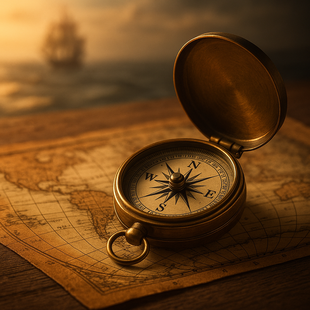
Table of Contents:
- Origins of the Magnetic Compass in Ancient China
- How the Magnetic Compass Spread Beyond China
- How the Magnetic Compass Evolved
- Magnetic Declination and Compass Deviation
- How the Magnetic Compass Changed Maritime Navigation
- Timeline of Magnetic Compass History
- How a Magnetic Compass Works
- From Magnetic Compasses to Modern Navigation
- Uses of the Magnetic Compass Beyond Sea Navigation
- Frequently Asked Questions About Magnetic Compass History
- Conclusion: The Continuing Evolution of the Magnetic Compass
Origins of the Magnetic Compass in Ancient China
The earliest chapter in magnetic compass history begins with the observation that lodestone, a naturally magnetized form of magnetite, tends to align in a consistent direction. In ancient China, direction had practical, ceremonial, and cosmological importance. Buildings, tombs, settlements, and ritual spaces could be oriented according to systems that connected the landscape with the cardinal directions.
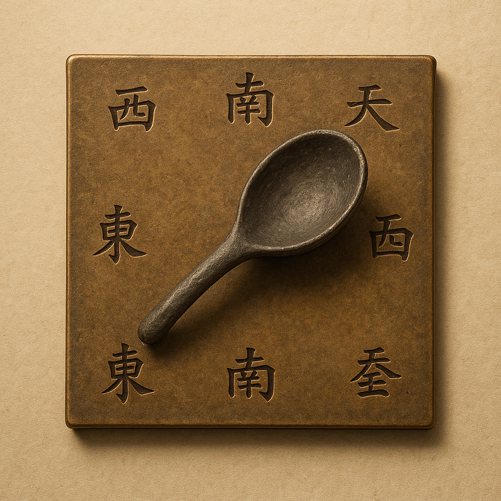
These early uses should not be confused with the later mariner’s compass. A spoon-shaped lodestone placed on a smooth plate is often presented as the “first compass,” but historians distinguish between reconstructed orientation devices, written descriptions of magnetic behavior, and instruments clearly used aboard ships. The transition from magnetic curiosity to navigational technology took place gradually.
During the Song Dynasty, the documentary record becomes much clearer. In 1088, the scholar Shen Kuo described methods of magnetizing a needle and observed that it did not point exactly toward astronomical north. In the early 12th century, Zhu Yu described Chinese pilots using a south-pointing needle when darkness or cloudy weather prevented them from relying on the sun and stars.
Those records mark the beginning of the compass as a practical navigational aid. They do not identify one inventor or a single invention date; that question belongs to the broader compass invention history covered in the article linked above. For this page, the key point is that Chinese scholars and sailors established the magnetic needle as a tool that could supplement existing methods of navigation.
How the Magnetic Compass Spread Beyond China
The spread of the compass was part of a much larger exchange of navigational knowledge across Asia, the Indian Ocean, the Islamic world, the Mediterranean, and Europe. Merchants and sailors already shared information about winds, currents, coastlines, ports, stars, and sailing seasons. Magnetic direction finding entered these existing traditions rather than replacing them.
The Compass in the Islamic World and Indian Ocean
Arabic-language sources indicate that magnetic compasses were known by the early 13th century. Mariners operating in the Red Sea, Persian Gulf, Mediterranean, and Indian Ocean combined the compass with astronomical observation, coastal knowledge, star paths, wind patterns, and written sailing instructions.
Magnetic direction also had uses beyond navigation. In some Islamic contexts, compasses helped determine the qibla, the direction of Mecca. This illustrates a recurring pattern in the history of the compass: the same magnetic principle could support religious orientation, architecture, land travel, and maritime navigation.
The Magnetic Compass in Medieval Europe
By the late 12th century, European writers were describing magnetic needles used at sea. The English scholar Alexander Neckam explained that sailors could use a magnetic needle when clouds or darkness obscured the stars. His account shows that the instrument had already entered practical navigation in Western Europe by approximately 1187.
European sailors and instrument makers gradually changed how the magnetic element was mounted and read. A floating or suspended needle could indicate direction, but it was inconvenient on a moving vessel. The development of pivoted systems, protective housings, compass cards, and gimbal mounts turned the compass into a permanent shipboard instrument.
Why the Route of Transmission Is Still Debated
It is often said that the compass traveled in a simple line from China through the Islamic world to Europe. Cultural contact and trade may certainly have helped transmit the technology, but surviving evidence does not document every stage of that route. Some historians have also considered whether forms of practical compass use could have developed independently after knowledge of magnetism became more widespread.
The uncertainty exists partly because early compasses were made from materials that rarely survive: iron needles, wood, thread, bowls, and simple boxes. Historians therefore rely heavily on texts, many of which describe an instrument without illustrating it. A careful account separates documented use from plausible but unproven transmission.
How the Magnetic Compass Evolved
The evolution of the magnetic compass was driven by practical problems. A needle had to rotate freely, remain readable on a moving vessel, resist vibration, and avoid interference from nearby iron. Over time, different designs solved different parts of that challenge. These changes produced the principal historical types of compass.
The Floating Needle and Early Wet Compass
One of the simplest arrangements placed a magnetized needle on a piece of wood, reed, cork, or another lightweight support floating in water. The water reduced friction and allowed the needle to turn until it aligned with the local magnetic field.
This early wet compass was useful because it required little specialized construction. However, a bowl of water was not ideal aboard a ship exposed to pitching, rolling, and sudden movement. The design also took time to settle and could be difficult to read continuously.
The Dry Compass and Compass Card
The dry compass replaced the floating needle with a magnetized needle balanced on a pivot. By the late 13th and early 14th centuries, this arrangement was becoming increasingly important in European maritime navigation. Enclosing the mechanism in a box protected it, while mounting it aboard the vessel made it available for continuous steering.
A circular compass card marked with directions could be attached to the magnetic system. As the card turned, the helmsman could compare the ship’s heading with the fixed reference line of the compass housing. This made the instrument easier to interpret than a bare needle.
The card’s directional divisions were associated with the compass rose used on nautical charts. Early systems often used named winds and compass points rather than the modern 360-degree scale. Together, the dry compass and compass card created a shared language for describing courses at sea.
The Bearing Compass
A steering compass shows the direction in which a vessel is traveling. A bearing compass allows the user to sight a distant object and measure its magnetic direction. Navigators could take bearings toward headlands, islands, lighthouses, or celestial bodies and compare them with positions shown on a chart.
This expanded the role of the compass from maintaining a heading to estimating location. If two or more known landmarks were visible, intersecting bearings could be plotted to create a position fix. Related bearing instruments also became important in surveying, mapping, military movement, and geological fieldwork.
The Liquid Magnetic Compass
The later liquid magnetic compass should not be confused with the early floating-needle compass. In a liquid-filled compass, the magnetic card or needle system is mechanically mounted inside a sealed housing. Fluid slows rapid oscillation, supports the moving assembly, and reduces wear on the pivot.
Liquid damping became especially valuable on steamships and other vessels affected by engine vibration. Designers also improved magnetic materials, pivots, seals, temperature compensation, and binnacles. These changes made marine compasses steadier, more durable, and easier to read in rough conditions.
Gimbals, Binnacles, and Shipboard Stability
Mounting was as important as the magnetic needle itself. A compass placed in gimbals could remain approximately level while the ship pitched and rolled. The instrument was often housed in a binnacle near the steering position, protecting it while keeping the card visible to the helmsman.
As vessels became larger and incorporated more iron, binnacles also became part of the solution to magnetic interference. Correcting magnets and soft-iron spheres could be positioned around the compass to reduce predictable errors caused by the ship’s structure.
Magnetic Declination and Compass Deviation
A magnetic compass does not point directly to the geographic North Pole. It aligns with the local direction of Earth’s magnetic field. The angle between magnetic north and true north is called magnetic declination, historically also known as magnetic variation.
Declination changes from place to place and also shifts over time because Earth’s magnetic field is not fixed. Navigators therefore needed charts, tables, and observations that showed the local variation. A compass bearing could then be corrected to obtain a true direction for use with a chart.
Compass deviation is a separate error caused by magnetic influences near the instrument. Iron fittings, cargo, electrical systems, tools, engines, and the vessel’s metal structure can pull the needle away from the direction it would indicate in an undisturbed location.
Understanding the difference between declination and deviation was a major step in the technical history of the magnetic compass. Declination comes from the relationship between geographic and magnetic north, while deviation comes from the vessel or nearby equipment. Accurate marine navigation required corrections for both.
The magnetic compass transformed navigation because it provided directional information when the sun, stars, and coastline were hidden. It did not tell sailors their exact position, calculate longitude, measure speed, or replace experience. Its value was more specific: it allowed a ship to maintain a chosen heading under conditions in which visual direction finding was unreliable.
Maritime Trade and Repeatable Routes
Merchants benefited from being able to follow a course through darkness, clouds, or open water. Routes could be repeated with greater consistency, and vessels could operate farther from familiar coastlines. In East Asia, the Indian Ocean, the Mediterranean, and Atlantic Europe, the compass became part of broader systems that connected ports and commercial regions.
The instrument did not eliminate the risks of sailing. Storms, reefs, poor charts, disease, damaged ships, and errors in estimating distance remained serious dangers. The compass reduced one form of uncertainty—the vessel’s heading—while other navigational problems still required different tools and skills.
The Magnetic Compass and the Age of Exploration
During the 15th through 17th centuries, mariners used magnetic compasses alongside nautical charts, celestial observations, dead reckoning, log lines, and knowledge of winds and currents. The compass helped expeditions maintain courses across the Atlantic, around Africa, and through the Indian and Pacific Oceans.
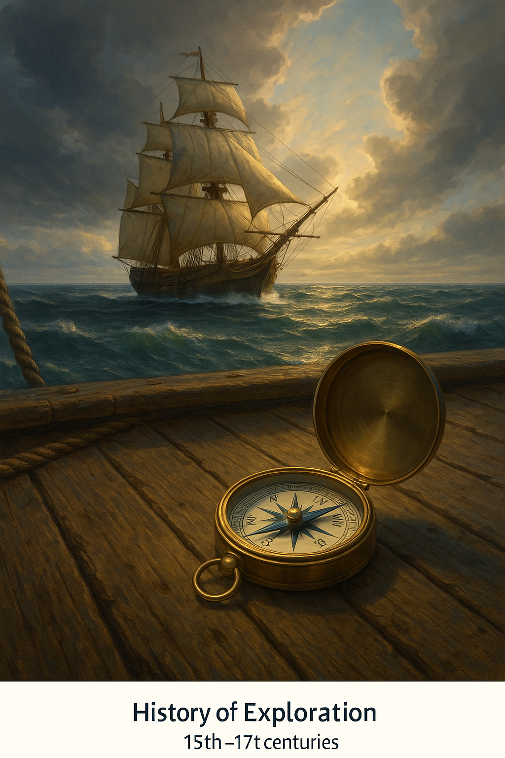
The resulting voyages expanded trade and geographic knowledge, but they also supported conquest, colonization, forced labor, and imperial competition. The compass was a neutral instrument whose historical consequences depended on the societies and powers that used it.
In AP World History, the magnetic compass is often discussed as a technology that supported expanding trade networks and cross-cultural exchange. A complete account should recognize its Chinese origins, its use across Asian and Islamic maritime systems, and the later European adaptations that helped make it central to oceanic navigation.
Cartography, Surveying, and Military Movement
Compass bearings also improved mapmaking and surveying. A direction measured in the field could be transferred to a chart, and intersecting bearings could help establish the position of a feature. Surveyors used related instruments to measure angles, map property, and connect visible points across terrain.
Military forces used compasses to maintain direction through forests, deserts, mountains, and unfamiliar territory. The compass could not identify the user’s exact location, but it helped troops follow planned routes and coordinate movement when landmarks were difficult to recognize.
Timeline of Magnetic Compass History
The following timeline summarizes the main stages in the history of the magnetic compass, from Chinese magnetic needles to electronic navigation. It emphasizes changes in use and design rather than treating the compass as a finished invention that appeared at one moment.
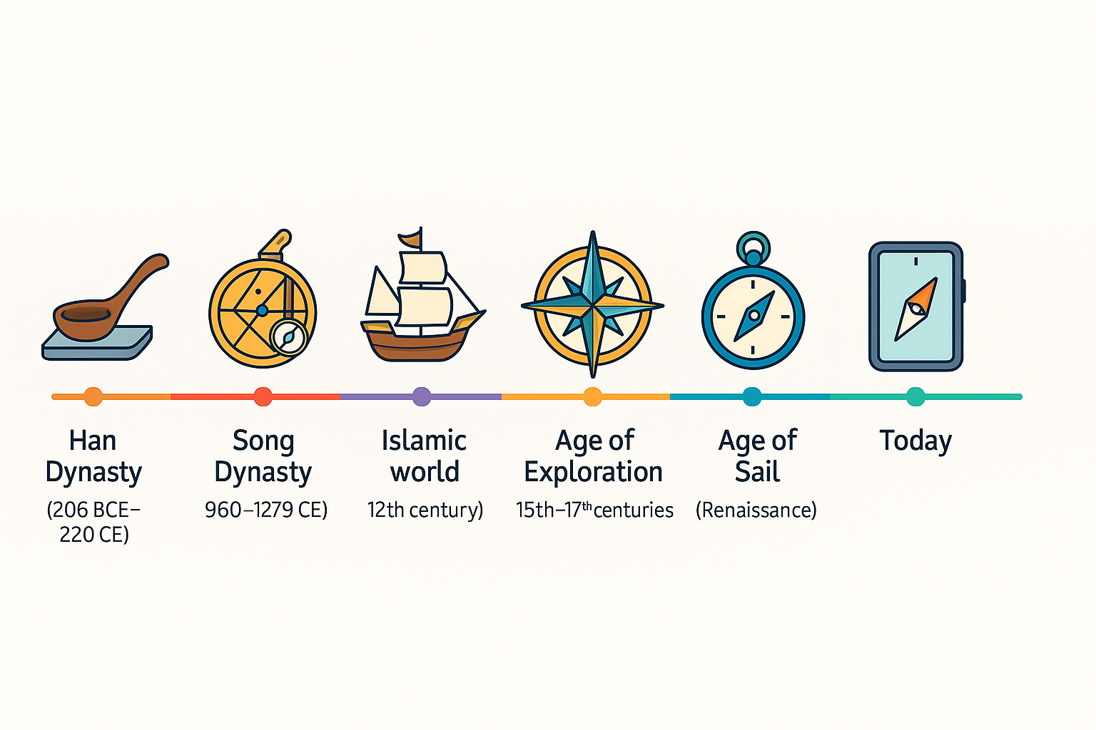
| Period | Development | Historical importance |
|---|---|---|
| Ancient China | Lodestone and magnetic orientation become associated with geomancy and directional practice. | Created the intellectual and practical background for magnetic direction finding. |
| 1088 | Shen Kuo describes a magnetized needle and notes its difference from astronomical north. | Provides clear written evidence of the magnetic needle and awareness of declination. |
| Early 12th century | Zhu Yu records Chinese pilots using a south-pointing needle in poor visibility. | Marks the earliest widely recognized written evidence of maritime compass use. |
| Late 12th century | Alexander Neckam describes magnetic direction finding among European sailors. | Shows practical adoption in Western Europe. |
| Early 13th century | Arabic-language sources describe magnetic compasses. | Demonstrates wider use in Mediterranean and Indian Ocean traditions. |
| Late 13th–14th centuries | Pivoted dry compasses and compass cards become more established. | Improves continuous steering and the communication of headings. |
| 15th–17th centuries | Marine compasses support expanding oceanic voyages and trade. | Strengthens long-distance navigation during the Age of Exploration. |
| 18th–19th centuries | Liquid damping, improved pivots, binnacles, and deviation correction advance marine design. | Adapts the compass to larger, faster, and increasingly metal-built ships. |
| Early 20th century | The gyrocompass offers a non-magnetic reference to true north. | Reduces dependence on magnetic readings aboard large vessels. |
| Modern era | Electronic magnetometers, inertial sensors, and GPS are integrated. | Combines magnetic heading with digital orientation and satellite position. |
For additional regional developments and related instruments, explore our wider collection of compass history articles.
How a Magnetic Compass Works
A magnetic compass contains a magnetized element that can rotate with minimal friction. In a handheld compass, that element is usually a needle. In many marine compasses, magnets are attached beneath a circular card. When the system settles, it aligns with the horizontal component of Earth’s magnetic field.
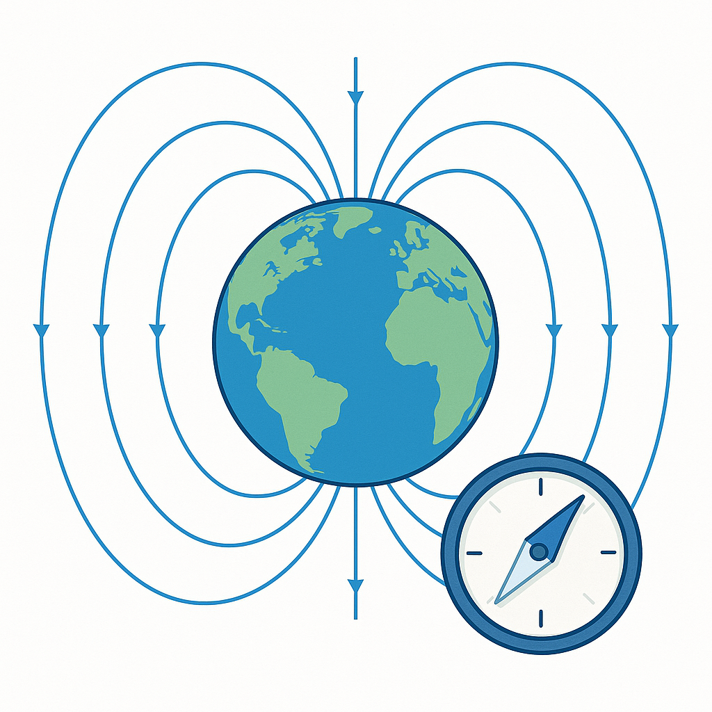
Earth’s magnetic field is generated by motions within its electrically conducting outer core. The compass responds to the local field around it, which is why its indication changes with location and can be disturbed by nearby magnetic materials.
The basic principle remained stable throughout the compass’s history, even as the surrounding instrument changed from a floating needle to a pivoted card, liquid-filled housing, and electronic sensor. Our detailed guide explains how a magnetic compass works, while this separate article shows how a compass is made.
New navigation technologies did not replace the magnetic compass all at once. Instead, each system solved a different problem. A magnetic compass indicated heading, a marine chronometer supported longitude calculations, celestial observations helped establish position, and charts organized geographic information.
The Gyrocompass
A gyrocompass is not magnetic. It uses a rapidly spinning gyroscope, Earth’s rotation, and controlled precession to establish true north. Because it does not depend on Earth’s magnetic field, it is not affected by local magnetic declination or the iron structure of a ship in the same way as a magnetic compass.
Practical gyrocompasses appeared in the early 20th century and became particularly valuable aboard large ships and naval vessels. They could provide true-north headings to multiple repeaters throughout a vessel, but they required power, maintenance, and time to settle.
Magnetometers and Digital Compasses
Modern electronic devices often measure direction with a magnetometer. The sensor detects components of the magnetic field, and software converts those measurements into a heading. Smartphones, drones, aircraft, vehicles, and marine instruments may combine magnetometers with accelerometers and gyroscopes.
A digital display does not eliminate magnetic error. Electronic compasses can still be disturbed by steel structures, speakers, electric motors, power cables, or magnets. Calibration and sensor fusion help reduce these problems, but the instrument continues to depend on the same magnetic field that guided early needles.
GPS and the Continuing Role of the Compass
GPS and compasses perform different functions. GPS calculates position from satellite signals, while a compass establishes direction. A receiver can know its coordinates without knowing which way it is facing, especially when it is stationary. A magnetic compass can indicate orientation without knowing the user’s location.
Modern devices often combine both systems. GPS tracks movement and position, while a magnetometer provides heading at low speed or while standing still. Traditional magnetic compasses also remain valuable because they require no satellite signal, network connection, software, or external power.

The history of the magnetic compass extends beyond ships. Land travelers used compact instruments to cross forests, plains, mountains, and deserts. Surveyors measured bearings to map property and terrain, while geologists recorded the orientation of rock layers, faults, and field sites.
Miners used magnetic direction finding underground, where the sun and stars were unavailable. Military forces relied on compasses for route planning and movement through unfamiliar terrain. Aviation, search and rescue, outdoor recreation, and engineering also produced specialized designs.
In Chinese traditions, geomantic compasses developed into complex instruments associated with Feng Shui. These contained multiple rings of directional and cosmological information rather than only a simple north–south indication. The compass also became a widespread symbol of guidance, purpose, exploration, and moral direction.
For additional uses, designs, and lesser-known historical details, explore our collection of interesting facts about the compass.
Frequently Asked Questions About Magnetic Compass History
How did the magnetic compass evolve?
The magnetic compass evolved from lodestone and magnetized needles into floating-needle devices, pivoted dry compasses, compass cards, bearing compasses, liquid-filled marine compasses, and electronic magnetometers. Each stage improved stability, readability, accuracy, or suitability for a particular form of navigation.
What is the difference between a dry compass and a liquid compass?
A dry compass uses a magnetized needle or compass card balanced on a pivot inside an air-filled housing. A liquid compass places the moving system inside a fluid-filled housing that dampens oscillation and makes the reading steadier. This later liquid design is different from the early wet compass, in which a needle floated directly on water.
When did the compass reach Europe?
Written evidence shows that magnetic needles were being used by European sailors in the late 12th century. Alexander Neckam described the practice around 1187. The exact route by which magnetic compass knowledge reached Europe remains debated.
Is a gyrocompass magnetic?
No. A gyrocompass uses a gyroscope and Earth’s rotation to indicate true north. It does not align with Earth’s magnetic field, so it is not affected by magnetic declination in the same way as a magnetic compass.
Why does a magnetic compass not point to true north?
A magnetic compass aligns with the local magnetic field rather than the geographic axis of Earth. The difference between magnetic north and true north is called magnetic declination, and it varies by location and changes over time.
Why are magnetic compasses still used with GPS?
GPS supplies position, while a compass supplies orientation. Magnetic compasses also remain useful as independent backups because traditional models do not require batteries, satellite reception, network coverage, or software.
Conclusion: The Continuing Evolution of the Magnetic Compass
The history of the magnetic compass is a story of continuous adaptation. Chinese scholars and sailors established the earliest documented magnetic direction-finding traditions, while navigators and instrument makers across the Islamic world, Europe, and other regions transformed the compass into a reliable tool for steering, measuring bearings, mapping, and long-distance travel.
Its design evolved from floating needles to dry compass cards, liquid-filled marine instruments, compensated binnacles, and digital magnetometers. Even the rise of gyrocompasses and GPS did not eliminate its usefulness. The magnetic compass remains relevant because it performs a fundamental task with a simple physical principle: it provides direction when other reference points are unavailable.

Learn more about compasses: